The reality is simple: sharing micromobility data with cities is critically important. Not only can it inform things like vehicle placement and density, but it can also help improve infrastructure and on-street safety—even for non-riders.
But the story doesn’t end there. Equally as important as the data itself is how it’s handled. Privacy concerns are valid and must be taken seriously, especially since laws can change dramatically from one place to another.
Cities and transportation operators have an obligation to work together to ensure that data is shared responsibly, that it’s secure and that riders are fully protected from reidentification. Here are three cities that are setting the bar for mobility data sharing best practices, and how they’re doing it.
Chicago, IL
Chicago is a great example of how cities can share scooter data publicly without compromising individual privacy. The city never asks for personal information. Instead, three principles are used to guide the preparation of data for public release:
- Aggregation over time
Trip timestamps are rounded to the nearest 15-minute interval so that exact start and end times are never shared. - Aggregation by geography
Start and end points are assigned to their corresponding census tract area so that exact longitude and latitude coordinates are never shared. - Aggregation by trip density
Data is only shared when there are three or more trips taken within the same census tract and time interval, ensuring that individual rides are never identifiable.
Louisville, KY
Louisville’s approach to open, anonymized data is similar to that of Chicago. The city does not request rider information, only data on vehicle movements that’s then thoroughly processed before being released.
- Aggregation over time
Like Chicago, Louisville organizes trip start and end timestamps into 15-minute intervals that serve to anonymize raw temporal data.
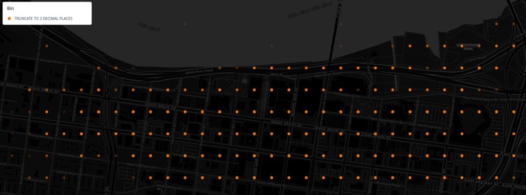
- Aggregation by geography
Latitude and longitude coordinates for trip start and end points are then shortened to three decimal places, creating a grid that’s approximately 100m tall and 80m wide.
- Aggregation by trip density
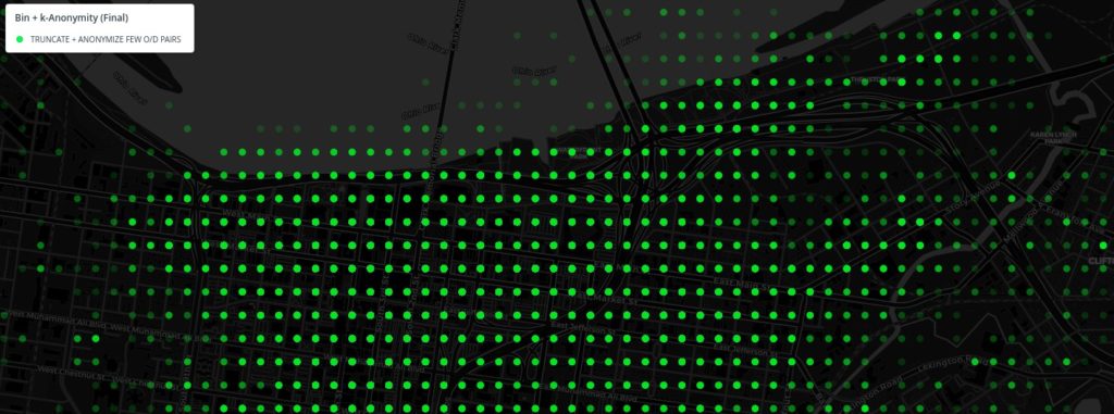
Whenever there are four or fewer trips starting/ending from the same point, locations are randomly moved in an 800m radius to further anonymize geographic data.
Sacramento, CA
Sacramento’s approach to data processing is a little different. The city leverages the Shared Streets open source tool which was specifically created to aggregate data and generate key insights while ensuring privacy protection for individuals.
The processing doesn’t stop there, either. Alongside the Shared Streets API, Sacramento has built a customized Esri dashboard, testifying to the California state legislature that this unique process has been able to turn aggregated insights into an effectively managed micromobility program.
Key Takeaways
Because city needs and regulations differ, data sharing solutions must be flexible and forward-looking. With consistent standards in place, and strong examples like those we see in Chicago, Louisville and Sacramento, we believe we can achieve the goal of providing cities with useful micromobility data while always protecting the privacy of their residents.